Is Hurricane Season 2016 Spinning Up?
By Stephen Bennett, Jon Davis, Mark Russo, Eric Adamchick, & Kyle Griffin
For the latest information and updates about tropical threats from our team of meteorologists, visit our Real-time Analysis page.
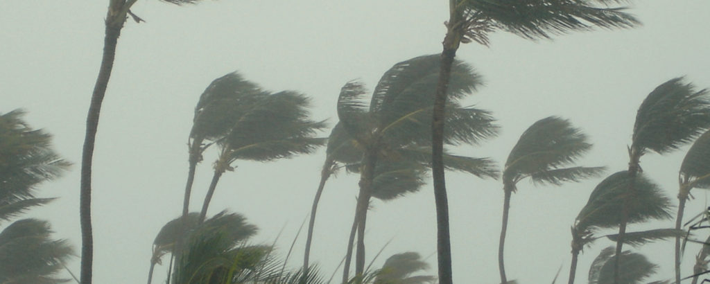
AS OF 2 PM CT, THURSDAY, 8/25: An area of disturbed weather that is near Hispaniola today could become the first Gulf hurricane to impact the United States since 2012.
Air Force Hurricane Hunter aircraft continue to investigate an area of low pressure that is moving toward Florida. This system will likely become Tropical Storm Hermine over the next few days.
Interests in the Southeast U.S. should follow this situation closely because it will impact the region over the next 5-7 days. It is too early and uncertainty is too high to forecast landfall location or wind speed along the coast, but heavy rainfall across much of Florida is quite likely beginning this weekend. Very heavy rain may spread across Georgia and the Carolinas early next week.
In the image below, you can see very heavy rain is likely over Florida and the Southeast U.S. as the system moves inland. More than 8” of rain is possible in some locations.
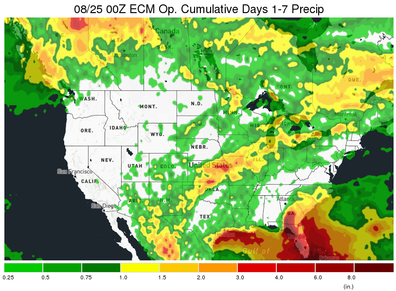
The Gulf Coast and Atlantic Seaboard continue to experience a drought of hurricane landfalls, with only four hurricanes reaching the United States since Hurricane Ike in 2008, the most recent of which occurred in 2014 with Hurricane Arthur. The last hurricane to impact Florida was Wilma in 2005, which marked the beginning of the current record-setting “hurricane drought” in Florida.
This forecast is constantly evolving and our Weather Watchtower is monitoring hundreds of new weather models each day. To access Real-time Analysis of the storm from our team of meteorologists, we created a live feed you can view here.
Related post

What Is a Risk Management Plan?
The Need for a Supply Chain Risk Management Plan What a year 2020 was for supply chains. No wonder more companies are going beyond supply…

Using Supply Chain Predictive Analytics to Reduce Risk
Supply Chain Predictive Analytics and Customer Service Service. It’s the difference between an average company and one that stands out from the rest. Forbes reports…
How to Mitigate Risk in The Supply Chain
The Supply Chain Risk Management Assessment A Deloitte Touche Tohmatsu survey found that 85 percent of global supply chains experienced at least one disruption in…